January 14, 2022–12:36 p.m.
NATIONAL WEATHER SERVICE
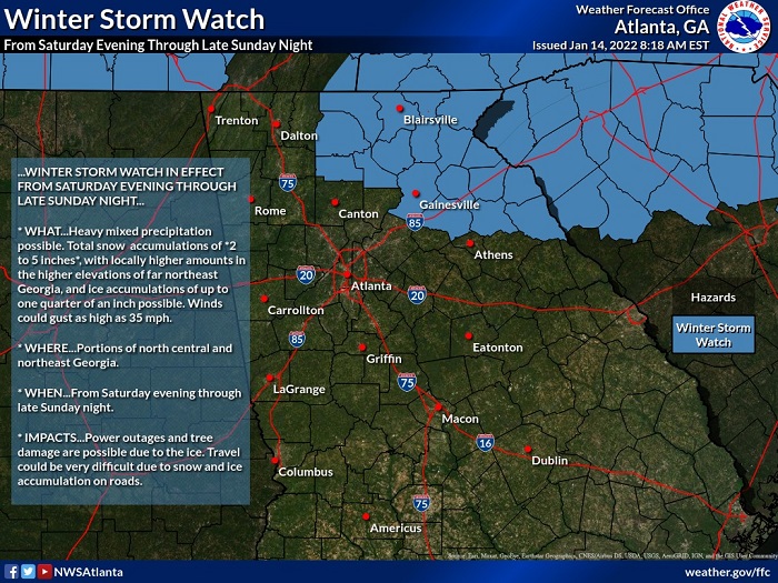
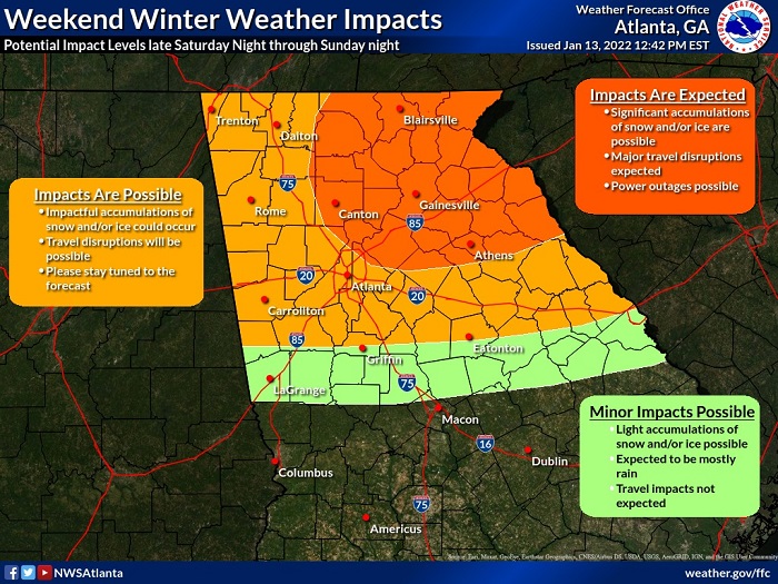
The rain will begin mixing with and changing to snow after midnight on Saturday night and switch to mainly snow over far northeast Georgia with a mix of rain, freezing rain, sleet, and snow over the rest of north Georgia during the day Sunday.
Light snow or snow flurries will be ending from west to east Sunday evening.
The heaviest snow will fall on Sunday over far northeast Georgia, where a Winter Storm Watch is in effect and up to 6 inches of snow is expected with higher amounts possible at elevations above 2000 feet.
Elsewhere across north Georgia north of I-20, up to 2 inches of sleet and snow and up to two-tenths (0.20) of an inch of ice will be possible.
South of I-20, there may be some snow or sleet mixed with the rain but little to no accumulation is expected.
After the precipitation clears out Sunday night, temperatures will fall into the 20s and any remaining liquid runoff from earlier precipitation will likely freeze on roadways across north
Georgia. These icy spots will persist well into Monday morning.