March 24th, 2021 – 2:40 PM
Floyd County Emergency Management –
Showers will increase across the area tonight with scattered to numerous thunderstorms spreading across the area tomorrow — primary concern for most active/severe weather across north & central GA, likely Thursday afternoon and evening.
Thursday:
A potential for widespread severe weather is expected across north & central Georgia. The primary threats will be strong to damaging winds and heavy rain. However…a brief tornado or storm with hail up to the size of quarters will also be possible. Heavy rain in north Georgia could also result in isolated flash flooding and elevate the flooding potential for area creeks, streams, and rivers. Please see notes and graphics below.
Overview:
- Scattered storms will develop overnight tonight and spread across portions of north Georgia Thursday.
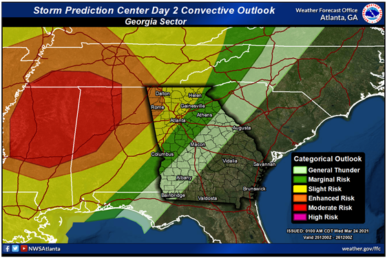
A Slight Risk is in effect for areas north and west of an I-85 line. An Enhanced Risk is in effect for areas north and west of a Rome to Dalton line.
Primary threats will be:
- Damaging winds > 60 mph
- Tornadoes
- Heavy Rain that could lead to Flash Flooding
- Isolated hail up to 1″